City of Newcastle moves to protect natural assets for future generations
30 May 2025
City of Newcastle is working to ensure the ongoing protection of more than 80 hectares of bushland and wetlands, which are home to threatened species and ecologically significant habitats.
The elected Council unanimously voted in April to seek input from the community on the formalisation of the status of 22 parcels of land across six Newcastle suburbs as community land managed as natural areas.
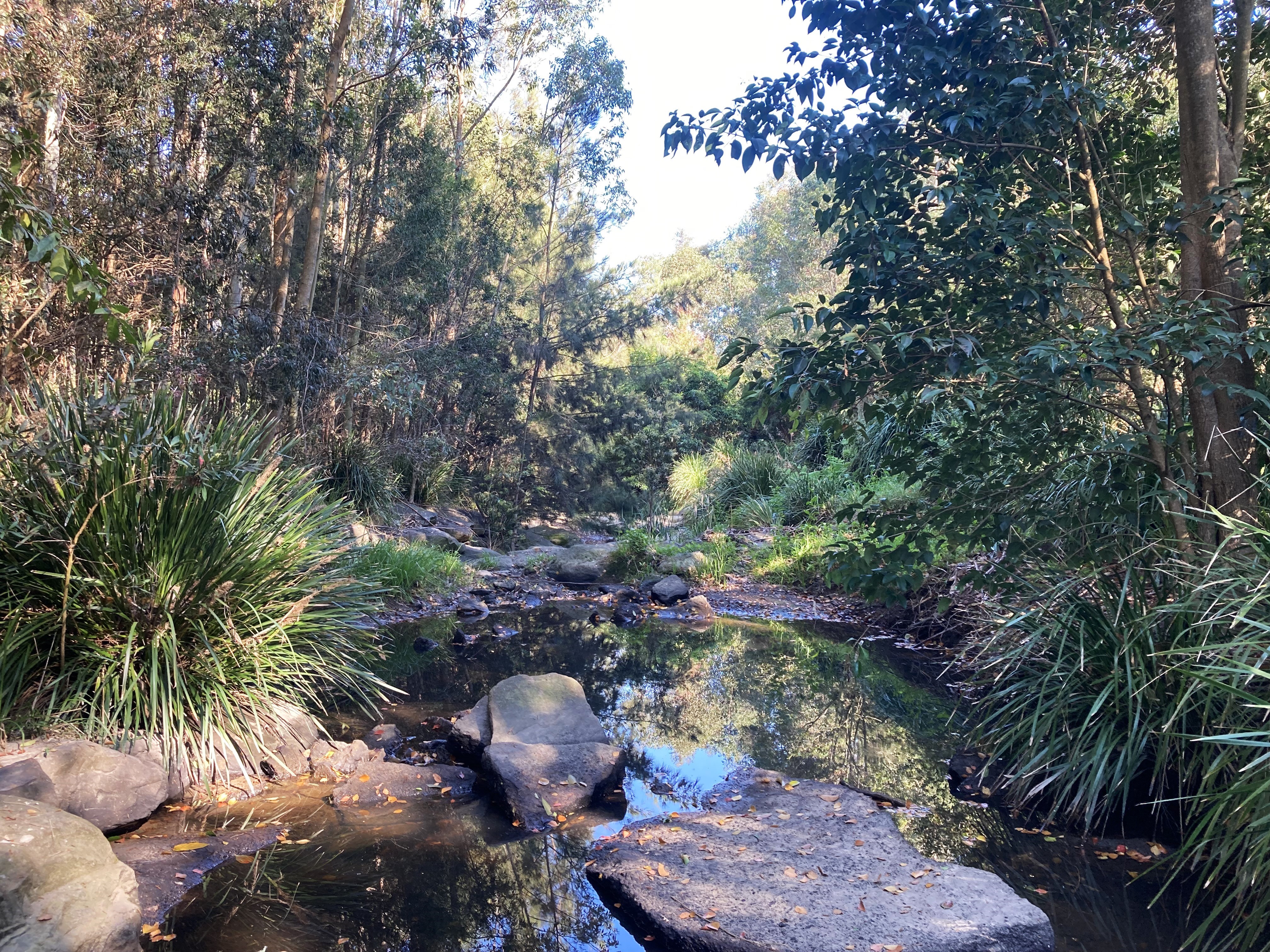 Image: Blue Wren Creek in Elemore Vale is one of the 22 parcels of land proposed for reclassification of community land.The areas, which combined cover the equivalent of 112 soccer fields, are currently classified as operational land or road reserves.
The community is invited to provide feedback on the proposed reclassification, which is designed to offer greater long-term protection for a range of bushland, wetlands and creek lines including areas adjacent to Blackbutt Reserve.
City of Newcastle's Executive Director Planning and Environment Michelle Bisson said Novocastrians have made it clear they want the city's natural assets to be protected and enhanced.
“With 65 wetland areas, 91 bushland parcels and 79km of urban creeks under our care, City of Newcastle recognises the intrinsic value of our environment and the benefits of nature to our society,” Ms Bisson said.
"These land parcels hold significant environmental, social, and cultural value for many in the community, and while they have been actively managed as natural assets for more than 15 years, reclassification will provide clarity for their future management.
“This process also aligns with our Newcastle Environment Strategy, which was developed with extensive community consultation and aims to improve the health and condition of our natural assets and biodiversity connectivity.”
The parcels of land range in size from a tiny 100 square metre area of Hunter Coast Spotted Gum adjoining the Blackbutt Reserve escarpment at New Lambton Heights, to 41.5 hectares of floodplain and wetlands around Ironbark Creek at Wallsend, which provides habitat for threatened and migratory species.
It also includes a significant 22-hectare wetland and woodland area at Black Hill, which forms an essential link in the biodiversity corridor between Stockton and the Watagans. City of Newcastle signed a Conservation Agreement with the NSW Government for the area in 2024.
Councillor Joel Pringle, Chair of City of Newcastle's Liveable Cities Strategic Advisory Committee, said accurately classifying public land parcels is an important step in sustainable, cost-effective land management.
"In addition to the long-term environmental benefits, the reclassification of these land parcels could also enable us to access external grant funding and, potentially, biodiversity offsetting opportunities," Cr Pringle said.
"I encourage the community to take some time to read through the proposal, understand its importance, and to have their say during the exhibition period."
The public exhibition period will run from Friday 30 May to Friday 27 June. A report summarising community feedback will be presented to Council to inform its final decision.
Submissions can be made online via the Have Your Say Newcastle website at https://haveyoursay.newcastle.nsw.gov.au/proposed-reclassification-land-parcels